
Circuit de l'Est
France, August 7th - 17th, 1910
France, August 7th - 17th, 1910
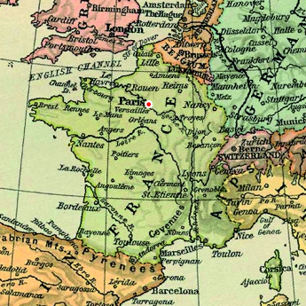
The Issy-les Moulineaux airfield
Because of the construction of the Eiffel Tower in 1889, the military exercise grounds at Champ-de-Mars were moved to a 63 hectare site south-west of central Paris in Issy-les-Moulineaux, which was then rural country. It first became an airfield in 1905, when Ernest Archdeacon was allowed to experiment with gliders there. It was then used by several aviation pioneers, for example Louis Blériot, the Voisin brothers and Henry Farman. Several aviation companies established in the area and built hangars around the field.
It was, however, primarily a military installation and aviation never got a permanent home there, even though it was used for exhibitions and test flights and was proposed as a civilian airport in 1936. It was bombed by the Germans in 1940 and afterwards used by the Luftwaffe. After WW2 the surrounding city grew closer and closer and it was no longer suitable for modern airplanes. It was last used for fixed-wing aircraft in 1953, but instead became the helicopter airport of Paris in 1956.
It is now known as the "Héliport de Paris - Issy-les-Moulineaux - Valérie-André" (IATA code JDP), and is still in use. Most of the old exercise field has been developed for housing, sports grounds, roads and other purposes.
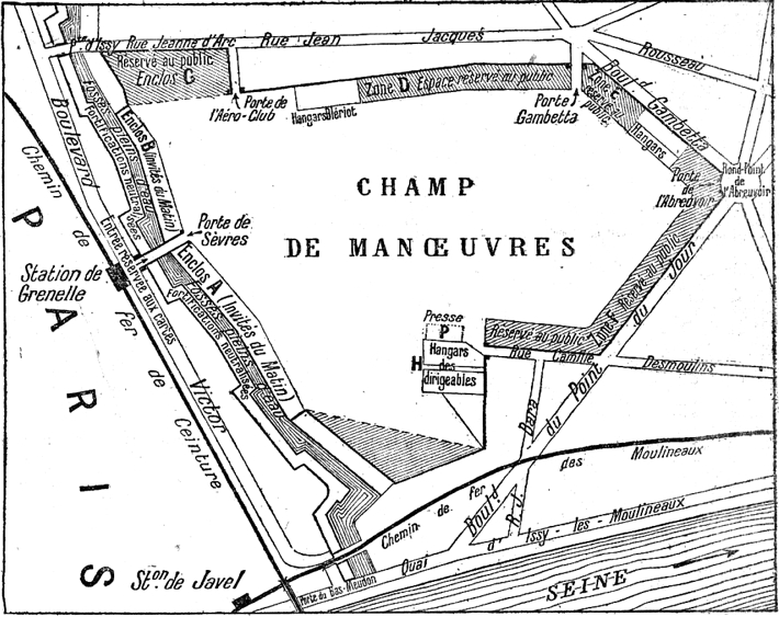
The layout of the Issy-le-Moulineaux airfield. North is
at eight o'clock. (1)
Click here for a high-resolution version!
Click
here for a high-resolution version!
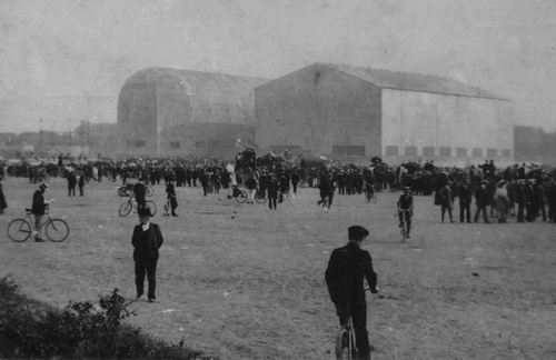
The big airship hangars at Issy-les-Moulineaux. (2)
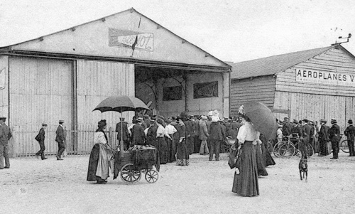
The Blériot and Voisin hangars, after the race. (3)
Too see more details, open the map in Google Maps by
clicking the "full screen" symbol at the top
right of the menu bar!
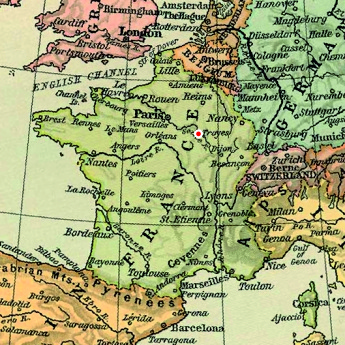
The Troyes - Pont Hubert airfield
The local meeting in Troyes was organized by the Club Aéronautique de l'Aube. It was the oldest aeronautic society in France, formed in 1901, and had launched 48 ascensions, carrying in total 133 persons, during its first ten years of operation.
The meeting was held on a military exercise field at Pont-Hubert, in the commune of Pont-Sainte-Marie around 2.5 kilometres north-east of the city centre. The field had since more than twenty years years also been used for horse racing.
A local pilot stationed his Hanriot at the Pont-Hubert field, but it was destroyed in an accident. The field was only briefly used for aviation, and it was reported that Blériot made some parachute experiments there in 1914. A new airfield was opened at Saint-Lyé, northwest of Troyes in 1911, close to the current Troyes-Barberey airfield, which was founded in 1933.
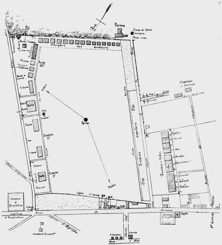
A plan of the Troyes - Pont Hubert airfield (from the
meeting program). North is at seven o'clock.
Clickhere for a high-resolution version!
Click
here for a high-resolution version!
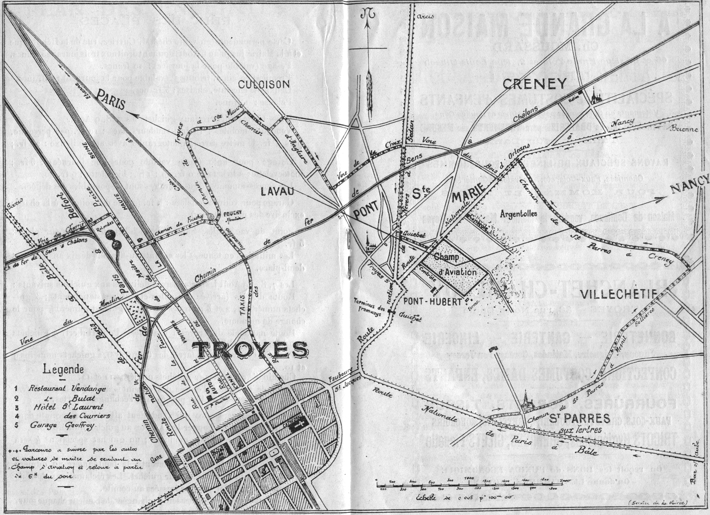
A plan of Troyes showing the location of the airfield
(also from the meeting program).
Clickhere for a high-resolution version!
Click
here for a high-resolution version!
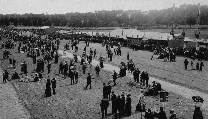
The spectator area of the Pont-Hubert airfield with its
bars and shops. (4)
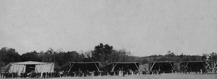
The rather primitive-looking hangars. (5)
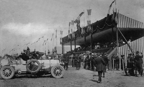
The honorary tribune. (4)
Too see more details, open the map in Google Maps by
clicking the "full screen" symbol at the top
right of the menu bar!
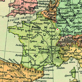
The Nancy/Jarville airfield
The airfield of Nancy was also originally a racecourse, located in the commune of Jarville-La-Malgrange, around three kilometres southeast of the city centre. It was first used for flying in September 1909, when Roger Sommer made flights during ten days on his Farman, during the "Exposition Internationale de l'Est de la France" in Nancy.
The local meeting was organized by a committee that included local politicians and officers and members from sporting and automobile clubs.
The airfield continued to be used during the following years, but it was too small and inaccessible to be suitable for the army, which instead started using a field at Malzeville. The Jarville airfield was abandoned at the beginning of WW1 and finally closed in 1922. Since then, the river Meurthe has been relocated and the huge characteristic slag heaps have been removed, so the site is unrecognizable.
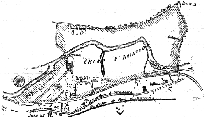
The layout of the Nancy/Jarville airfield. North is at
ten o'clock. (6)
Clickhere for a high-resolution version!
Click
here for a high-resolution version!
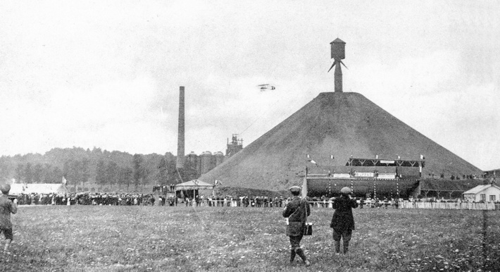
Georges Legagneux flying above one of the big
"crassiers" that lined the Nancy/Jarville
airfield. (7)
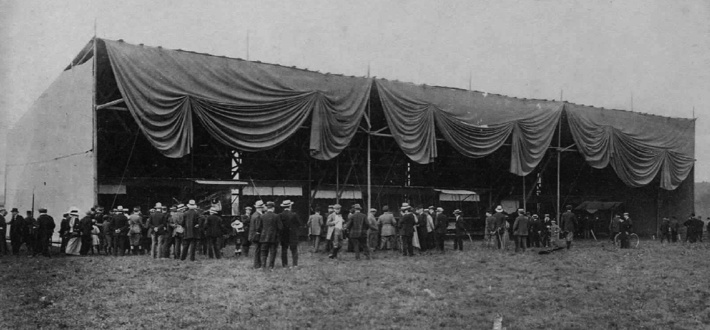
One of the big fabric-fronted hangars. (7)
To see more details, open the map in Google Maps by
clicking the "full screen" symbol at the top
right of the menu bar!
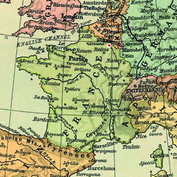
The Mézières-Charleville/Villers-Semeuse airfield
The airfield of Mézièrs-Charleville was located in the village of Villers-Semeuse, around three kilometres southeast of the town. It was a temporary airfield, and it was apparently only used for this event. During WW1 the region was occupied by Germany. The site is now crossed by a motorway and covered by shopping and industry installations.
The event was organized by a committee of local business, automobile and press persons, headed by M. Desvilles, president of the local chamber of commerce.
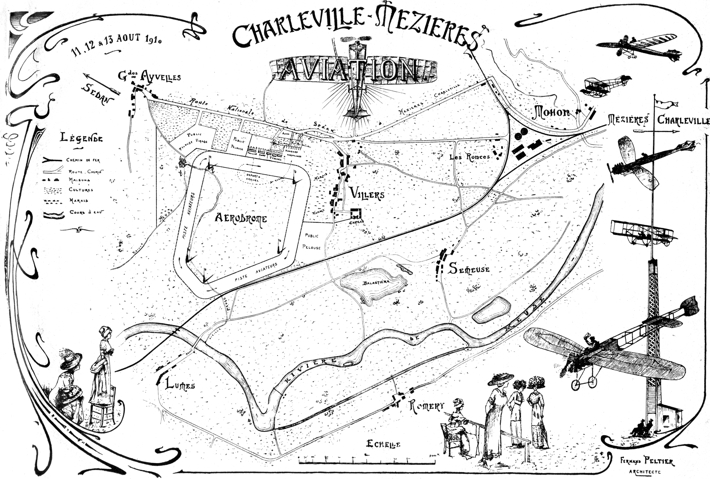
A map of the Mézières-Charleville airfield from the
meeting program. North is at five o'clock.
Clickhere for a high-resolution version!
Click
here for a high-resolution version!
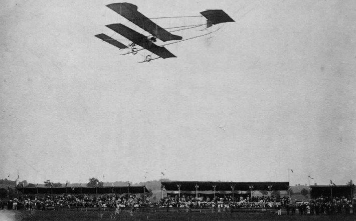
A Sommer flying in front of the grandstands. (8)
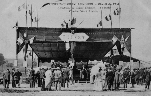
Celebrations after the arrival of Aubrun at one of the
airfield buffets. (9)
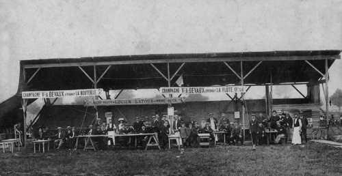
Another of the airfield buffets. (9)
Too see more details, open the map in Google Maps by
clicking the "full screen" symbol at the top
right of the menu bar!
The Douai/La Brayelle airfield
Louis Breguet was director of a family business which produced electrical machinery since 1902. In 1908, together with professor Charles Richet, he founded the "Société des ateliers d'aviation Breguet-Richet" and constructed an airfield at the company site at La Brayelle, in the flat farmlands some 3 kilometres west of Douai. The field covered some 72 hectares and had a fenced-in enclosure at the north end for hangars and workshops. After the 1909 Douai meeting it became the centre for the growing Breguet aviation company.
The Circuit de l'Est committee at Douai consisted of four persons and included the mayor of the town and Louis Breguet. They had engaged the Société Douaisienne d'Encouragement de l'Aviation the task of running the meeting.
During World War One The Douai area was occupied by German forces and the field was used by the German air forces. The field continued to be used after WW1 and hosted some meetings during 1920s and 1930s. It was closed during the 1950s.
Today nothing remains of the field. The area is used for farming and some parts are covered by a big Renault car factory and some businesses.
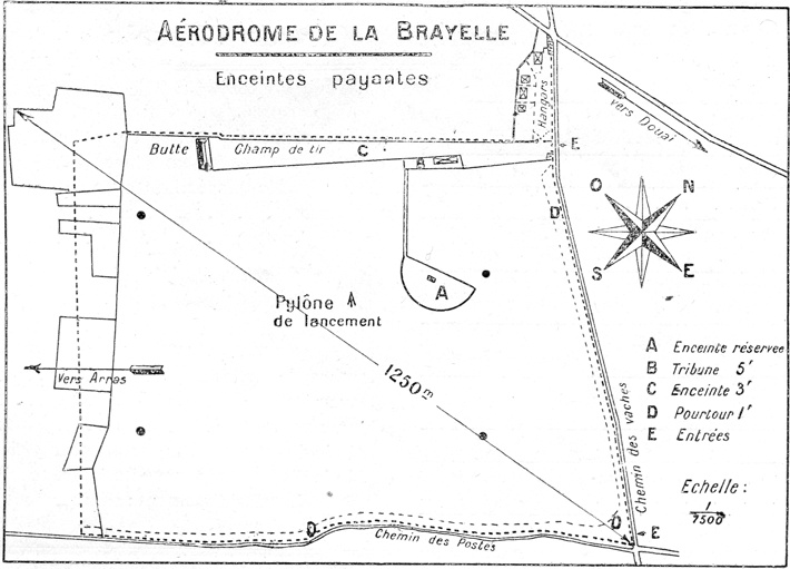
A plan of the La Brayelle airfield during the 1909
meeting. (10)
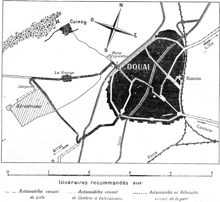
The location of the airfield in relation to the town of
Douai. (10)
We have not been able to find any good photos from La Brayelle during the Circuit. Please let us know if you know of any!
We have not been able to find any good photos from La Brayelle during the Circuit. Please let us know if you know of any!
Too see more details, open the map in Google Maps by
clicking the "full screen" symbol at the top
right of the menu bar!
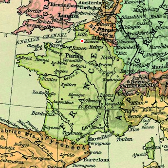
The Amiens airfield
The Amiens airfield was also a temporary installation, and we are not certain about its exact location.
The Montjoie airfield, located around three kilometres south of central Amiens, was used between the wars, and it has been stated that it was the site of the 1910 Circuit de l'Est airfield. The 1910 airfield was, however, referred to as the "Croix-Rompue" airfield, and according to newspaper reports it was located around two kilometres from Place René-Goblet. This would indicate the it was located north of the Montjoie airfield, closer to the part of the town called Croix-Rompue. Furthermore, the Montjoie airfield would have been too small for the 3-kilometre triangular course used.
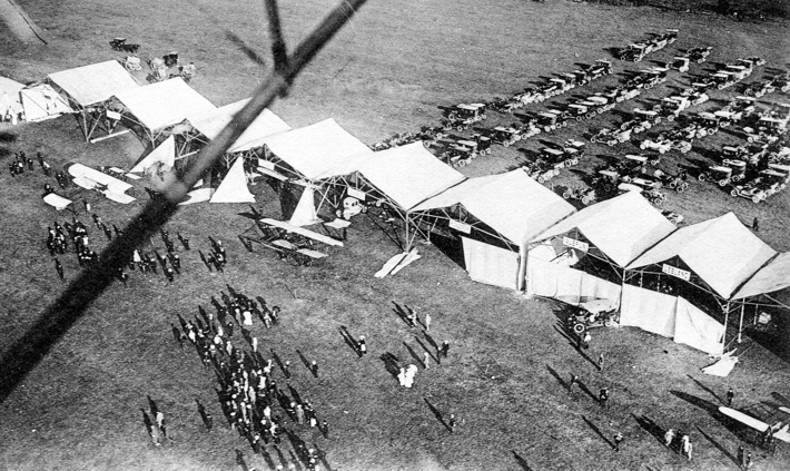
An aerial view of the Amiens hangars. (8)
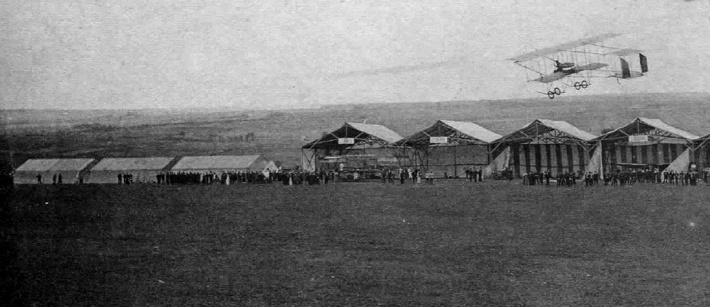
A Farman flying low over the hangars. (8)
Too see more details, open the map in Google Maps by
clicking the "full screen" symbol at the top
right of the menu bar!
Back to the top of the page