
Semaine d'Aviation de Genève
Viry, France, August 14th - 21st, 1910
Viry, France, August 14th - 21st, 1910
The Viry airfield
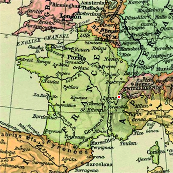
The field was located around 15 kilometres southwest of Geneva, and less than two kilometres from the border between France and Switzerland. The field was situated immediately northeast of the Château de Viry and the village of Viry. It was bordered on the north side by the railway and on the south side by a road. It was around 1.1 kilometres long and 600 metres wide, and covered 68 hectares. The measured course was 1,900 metres long and defined by nine pylons.
After the 1910 meeting the field was used for two more meetings in 1911. The first one, in April, suffered from hard winds and only Armand Dufaux flew. A second meeting was organized in August, but despite contracting well-known flyers Georges Legagneux and Marcel Loridan it was not a great success. The Dufaux brothers sold their company to Ernest Failloubaz and therefor didn't need a local airfield. The other Geneva flyers ran out of money and/or enthusiasm, and in October 1912 the shareholders of the "Société Anonyme de l'Aérodrome de Viry" decided to dissolve the company. Most of the hangars were demolished, but the field was still maintained as an emergency airfield. It was used for a one-off meeting in 1935 and towards the end of 1945 it was again used for glider flying. The de Viry family continued to maintain the field for possible airfield use, but in 1948 the French aviation authorities decided to close the airfield. The field returned to agricultural use, but the last hangar was not dismantled until 1970. A motorway has been built along the northern edge of the field, but otherwise the area appears almost unchanged since 1910.
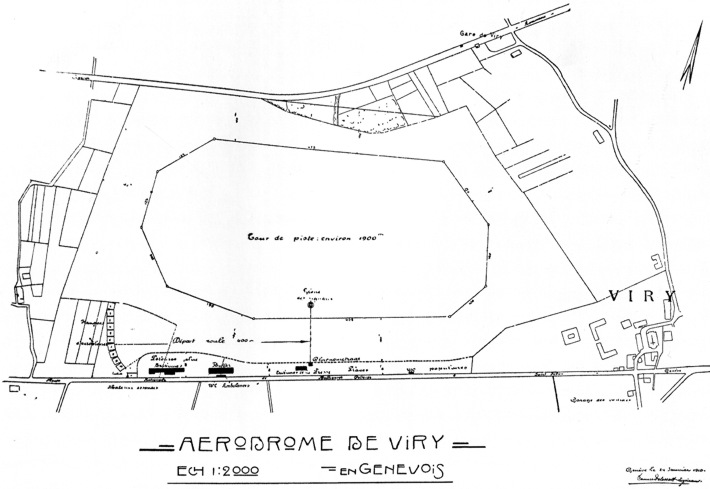
A map of the airfield from the meeting program. North is at one o'clock. Click
 here for a
bigger version!
here for a
bigger version!
here for a
bigger version!
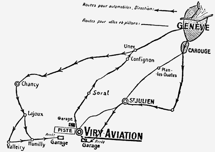
A sketch of the access roads from the meeting program.
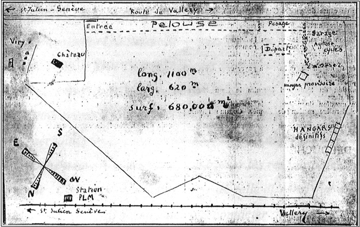
An earlier (December 1909) sketch of the airfield. North is at
seven o'clock. (1)
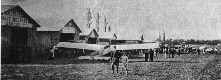
A view of the hangar area. The machine in the foreground must be
Alphonse Carfagni's modified Blériot. The hangar on the left is marked "Garage
Moderne", which was a company owned by Carfagni. (2)
Too see more details, open the map in Google Maps by clicking the "full screen"
symbol at the top right of the menu bar!
Back to the top of the page