
International Aviation Meeting
Bournemouth, UK, July 11th - 16th, 1910
Bournemouth, UK, July 11th - 16th, 1910
The Bournemouth/Southbourne airfield
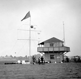
The timing pavillion. (1)
For preparing the airfield it was necessary to remove about three miles of hedges and earth banks. Around forty land-owners were compensated for the use of their grounds during three months, at a total cost of £ 2,200. The airfield was formed a bit like a natural basin but was very level. The course was somewhat unusual, with a four-pylon trapezoidal layout with two long straights and two very sharp, almost hairpin, turns. The length of the course was 3,140 yards, that is 2.874 kilometres.
There were four grandstands. The first-class stand was opposite the start/finish line and close to the fifteen hangars at the west end of the airfield, so that take-offs and landings were in plain view. It was also close to restaurants and to the "music lawn" with its bandstand. The second-class stand was situated along the course, at the first pylon, where the machines could be seen in full flight, and it had its back to the afternoon sun. The third-class stands were further away, and the northern of them had the disadvantage of facing the sun during the afternoon and evening. All the public enclosures were fenced from the course by a plank fence about four feet high, stated to be strong enough to protect the spectators from wayward aeroplanes. In order to give spectators a view of the sea flights the organizers had organized transport from the airfield to Hengistbury Head, also known as Christchurch Head, a sandstone cliff east of the airfield.
The airfield was only used for this single event. Flying in the Bournemouth area continued at the Talbot Village airfield north of the town, and from 1917 at the Ensbury Park airfield a bit further to the north, which closed around 1930. Seaplanes flew frequently from Bournemouth Pier, and the 1919 Schneider Trophy race was held in Bournemouth.
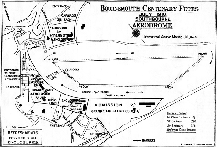
The map from the meeting program. North is at ten
o'clock.
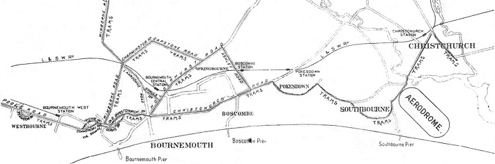
A map from the program of the centenary fêtes, showing
the position of the airfield and its access roads.
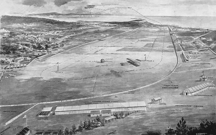
An artist's bird's eye view of the airfield,
looking towards the east. (2)
Click here for a high-resolution version!
Click
here for a high-resolution version!
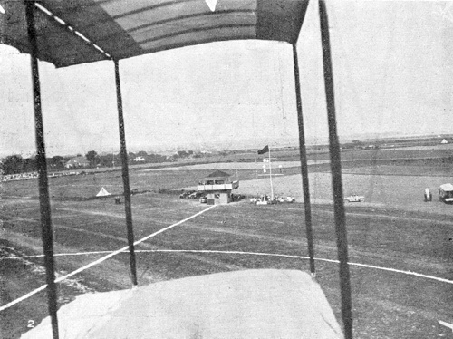
The timing pavillion, photographed from Claude
Grahame-White's Farman. The start/finish line and
the circle marking the target for the precision landing
contest can be seen on the ground. (3)
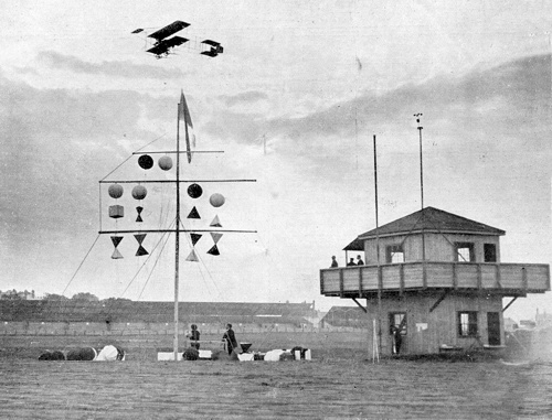
A close-up of the timing pavillion and the signal mast,
with Grahame-White flying above. It's difficult to
tell the colours, but the signals (which are seen from
behind) probably mean:
- At the top: Red flag, indicating that flights are going on.
- Top spar: Number 12, indicating a wind between 3 and 5 mph.
- Second spar: Pilot identifications, left to right Dickson, Grahame-White, Rolls and Christiaens.
- Third spar: Contest identifications, left to right altitude, longest flight, altitude, longest flight. (3)
- At the top: Red flag, indicating that flights are going on.
- Top spar: Number 12, indicating a wind between 3 and 5 mph.
- Second spar: Pilot identifications, left to right Dickson, Grahame-White, Rolls and Christiaens.
- Third spar: Contest identifications, left to right altitude, longest flight, altitude, longest flight. (3)
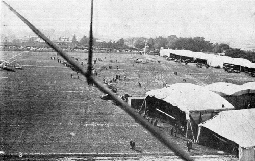
Another photo taken from Grahame-White's machine,
this time showing the hangar area. (3)
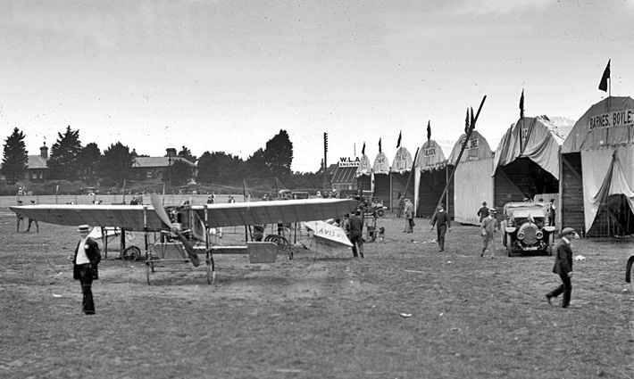
A nice photo of the activity in the hangar area, with
Barnes' Humber in front of Boyle's Avis. (4)
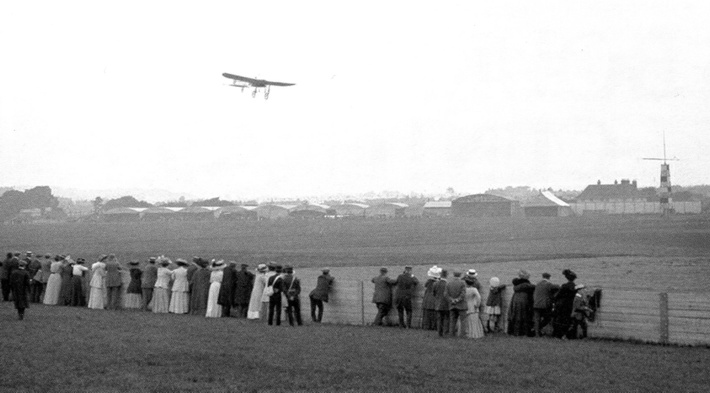
A Blériot flying, with the hangars in the background.
(5)
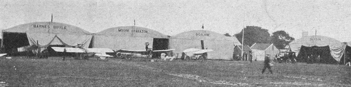
Some of the hangars. (6)
Too see more details, open the map in Google Maps by
clicking the "full screen" symbol at the top
right of the menu bar!
Back to the top of
the page