
Grande Semaine d'Aviation
Rouen, France, June 19th - 26th, 1910
Rouen, France, June 19th - 26th, 1910
The Rouen/Les Bruyères airfield
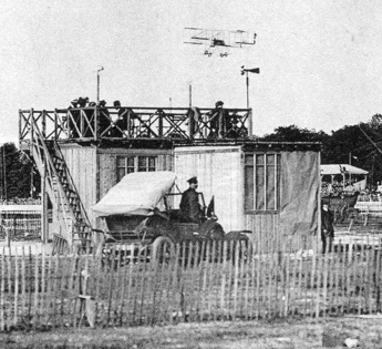
The time-keepers' pavillion. (1)
It was marked up with a five-pylon three-kilometre race course, and twenty hangars were built, one for each participant. As usual, a minor town was built up around the airfield, with grandstands, restaurants, bars, shops, post and telegraph offices and a music pavilion. All the airfield installations were temporary, but some of them would be reused at other events. For example, the signal mast and the related equipment were sold to the organizers of the upcoming Reims meeting, and the grandstands would later be used at an agricultural show.
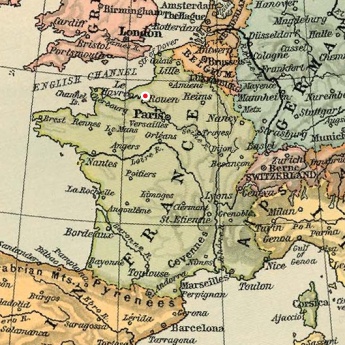
The airfield was situated on a peninsula formed by the meandering Seine. Located on a plateau and bordered by the trees of the Forêt de la Rouvray it was afflicted by turbulence, which caused several accidents and incidents during the meeting.
The forest background behind the grandstands is very typical and can be recognized in photos on many postcards that pretend to be from other meetings, for example from the Reims and Baie-de-Seine meetings in July and August.
The airfield was only used for this single event in 1910, but around 1930 it would be reborn as the Rouen-Madrillet airfield, home of the Aéroclub de Normandie. It was closed in 1968 and the club's activities moved to the new Rouen-Boos airfield some ten kilometres to the east, now known as the "Aéroport Rouen-Vallée de Seine".
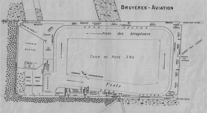
A map from the official program, showing the different
airfield installations. North is at two o'clock.
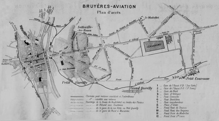
Another map from the program, showing the location of
the airfield in relation to the centre of Rouen. This
time north is at eight o'clock. Click  here for a high-resolution version!
here for a high-resolution version!
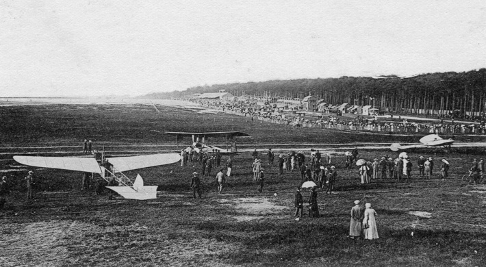
A panorama over the airfield, as seen from the hangar
area. In the foreground Dubonnet's Tellier, with
Bathiat's Breguet and Morane's Blériot further
away. (2).
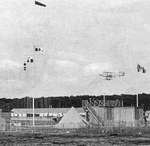
The time-keepers' pavillion and the signal mast.
The signals were similar to those used at most French
aviation meetings. At the top of the mast is the red
flag that signals that official flights are
allowed.
The signal on the right side is number 168 or 169, depending on whether the cylinder is black or red. This indicates the wind speed, 5-7 or 7-10 m/s respectively.
On the top left spar the white ball and black cone indicate Dickson, and the white/black cylinder indicates a flight for the total flight time prize. To confirm, the Farman flying by looks very much like Dickson's.
On the second left spar the black ball and red double cone indicate Cattaneo. (1)
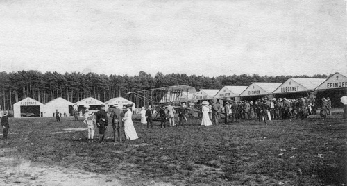
The hangars were arranged in a U shape at the southern
end of the airfield. (1)
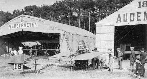
Most of the flyers had wooden hangars, but Verstraeten
and a couple of others had Bessonneau hangars. It looks
like there's a spare Demoiselle in Audemars'
hangar. (1)
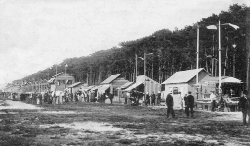
Let's take a walk away from the hangars, along the
kiosks and bars and other temporary buildings on the
east side of the airfield... (3)
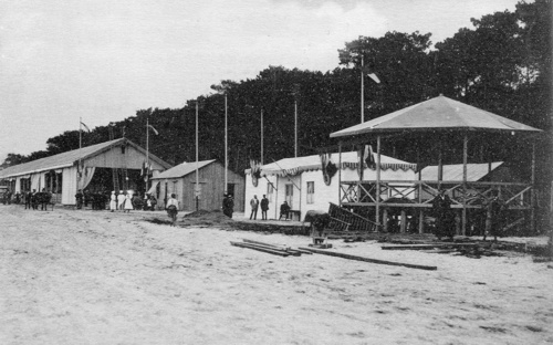
The nearest building is a barber shop. The tall
building beyond the four little huts is the press
pavillion. (1)
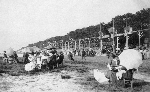
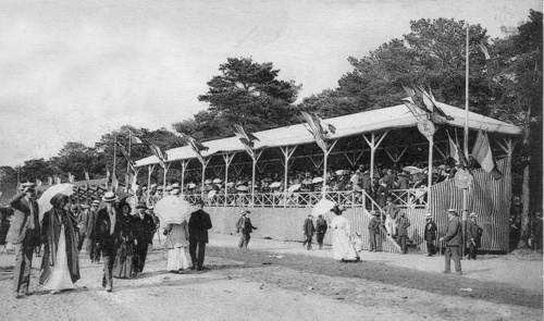
Further on, we come to the main grandstands. (1)
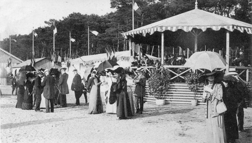
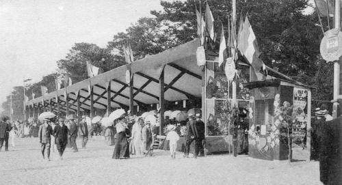
Beyond the main grandstands we find the music
pavillion. (4)
On the other side of the music pavillion is the offices
of the race committee, facing the start/finish line and
the time-keepers pavillion and the signal mast inside
the course. (3)
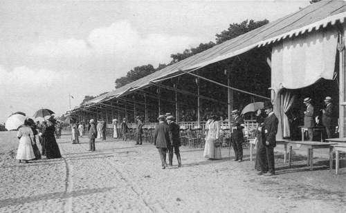
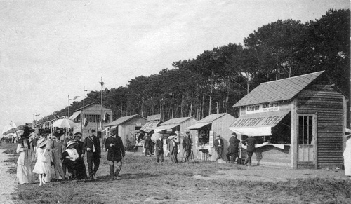
Then we come to the main buffet restaurant, where the
awnings are now extended to protect from the afternoon
sun. (1)
On the other side of the buffet restaurant we find the
cheaper grandstands, further away from the hangars. (1)
This is the last building along the main straight of
the course, the smaller buffet restaurant on the other
side of the cheaper grandstand. (1)
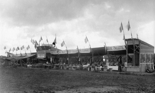
This is the buffet restaurant in the open public area
on the opposite side of the airfield. It sells
Paillette beer, made by the brewery in Le Havre that
was owned by the family of pilot Marcel Paillette. (5)
Too see more details, open the map in Google Maps by
clicking the full screen symbol at the top right of the
menu bar!
Back to the top of the page