
Semaine d'Aviation de Mondorf-les-Bains
Mondorf-les-Bains, Luxembourg, June 5th - 12th, 1910
Mondorf-les-Bains, Luxembourg, June 5th - 12th, 1910
The Mondorf airfield
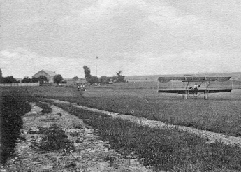
The view towards the northeast from the hangar area, with the
Daundorf farm buildings on the left and the signal mast in the
middle. De Petrovsky in his Sommer, with its typical semi-circular
ailerons, is taxiing back after a landing. (1)
Articles published before the meeting optimistically described the airfield as 500 metres wide, with two straights of each 3 kilometres, but this doesn't fit with the actual contests, and hardly with the topography of the surrounding areas either.
The course used for the daily single-lap contests was 2.5 kilometres. It appears that it only had two pylons, in the form of poles with Luxembourg tricolour flags, with a line of white flags between. There can't have been room for much within the park, which was only some 250 metres wide. The 12-kilometre event was reportedly run over eight laps of a 1.5 kilometre course.
The six hangars were located along the southwest side of the park, with a 100 metre long grandstand on the northwest side and large uncovered spectator areas further away. The hangars had their backs against the Avenue des Bains and were only about a hundred metres away from the river Gander, which is the border against Lorraine, which was then part of the German Empire.
Apart from the test flights during the spring of 1910, the airfield was probably only used for this single event. We have not found any trace of further flying experiments by Bettendorf and Jacques Wiesenbach.
Around half of the park has now been developed for housing, but the rest still remains.
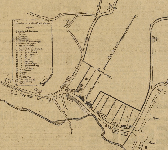
A map of the hangar area, with north at eleven o'clock. The
course stretched further away to the northeast.
Click here for a high-resolution version! (2)
Click
here for a high-resolution version! (2)
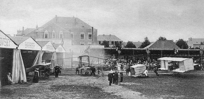
Action in the hangar area on the first day of the meeting: De
Caters' crew are holding on to the tail of his Voisin, while the
exhaust smoke from the start of the engine is blown away by the
slipstream. Christiaens' Farman and Barrier's Blériot are
waiting for their turns. (3)
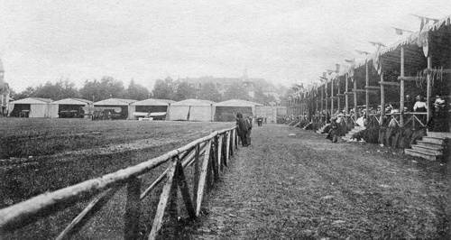
A view of the grandstands and the hangars. (1)
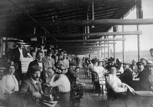
An interior from the grandstands. (4)
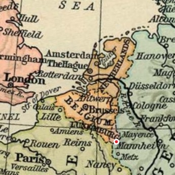
An approximate map of the airfield. Too see more details, open it in
Google Maps by clicking the "full screen" symbol at the top
right of the menu bar!
Back to the top of the
page